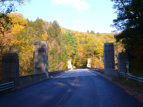
On Sunday, October 13, I participated in the Great River Ride, an event that starts and ends at the Sons of Erin in Westfield, Massachusetts. Organized by New Horizons Bikes, the GRR offers rides from 35 to 109 (really 111) miles. I signed up for the longest, choosing the option of riding it as a 170K “populaire” sanctioned by Randonneurs USA (RUSA).
This was the third RUSA event I had signed up for since joining the organization in 2010. I had signed up for a 200K brevet that spring, but ended up not riding because I hurt my leg a few days before it—getting out of bed in the morning! (A sign I am no longer young.) I did 200K the following weekend, but not as an approved event. Then in fall 2012 I signed up for the 100K populaire (62 mile) version of the Great River Ride, and started it, but a mechanical failure early on led me to shorten the course to only 28 miles or so.
This summer I had done a century in June (the 100 Miles of Nowhere), the 100K version of D2R2 in August, and had ridden 100 miles per week, on average, since mid-April. I was still not sure about the 170K GRR, which has nearly 9,000 feet of climbing in the Berkshires. But there were a couple points where I could bail out and do a relatively short ride back to Westfield, so I thought I’d give it my best shot.
Getting started
The populaire was scheduled to begin at 7 am, so I was up at 5:30 and on the road, a cup of coffee in hand, a little after 6. The drive to the Sons of Erin was uneventful; I was there by 6:50, quickly got my bike ready, and then signed my waiver and got my ride card. The volunteer working the registration remembered my name, even though I had done the ride only once before! (I suspect she may be on the listserv for the Pioneer Valley chapter of MassBike, in which case she might have seen my name and Gmail profile picture on a couple of recent posts.) I needed to dash back to the car to drop off the commemorative water bottle that I got for registering early, so it was 7:03 when I hit start on my GPS and rolled out of the parking lot. It was about 45 degrees Fahrenheit; I was wearing bib shorts, a light long-sleeved wool jersey, and a light jacket.
The rules of randonneuring require that rides be completed within a set time; each of the four checkpoints had an opening and closing time, and there was an overall limit of 11 hours and 20 minutes to complete the course, including stops. I had looked at the course profile and calculated how long it would take me to get to each checkpoint if I were having a great day, if I were riding at an average pace, and if things went south. I didn’t want to start out too strong, which was nearly my ruin in the 100 Miles of Nowhere. I figured that I should be able to do the entire ride well within the time limit, as long as my endurance didn’t give out.
Westfield to Worthington: 26.74 miles, 2:19:55 riding time
The first checkpoint was 27 miles down the road. Getting there required a little flat riding, then a long, steep climb where last year I had sheared off the bolts that held my small chainring to the crank. This time I made it up without any problem, though I stopped at the bottom of the hill to take off my jacket, figuring I would heat up during the climb. I was right, though I later lost that heat on a descent.
The long slog uphill elevated my heartbeat and my body temperature. It was even worse than I remembered, probably because the previous time I had done it, I took an involuntary break partway up. Still, it ended; then there was a flat bit through Montgomery and then a long descent to Route 112 in Huntington. I hit 41 mph on the steepest downhill bit, then feathered my brakes as I entered a twisty stretch of road. At one point I was passed by an idiot cyclist who must have been doing 50 mph. Another rider and I commented on his idiocy when we reached the flat.
Another 13 miles north on Route 112, climbing slowly with a few steep bits. I stopped at one point to put my jacket back on. Then I reached the first checkpoint, pulling in at 9:28 am. My “good” time had me here at 9:17, and my “OK” time at 9:47, so I was doing pretty well.
I had my ride card signed with the time, then scarfed down a couple mini bagels with peanut butter and cream cheese, filled my water bottle with Gatorade powder and water, grabbed a cup of coffee at the country store across from the checkpoint, and stood in line for the porta-john. Twenty-four minutes later, I rolled out toward the north. I had spent 9 more minutes at the checkpoint than I had planned, but I was still on schedule.
Worthington to Windsor: 20.41 miles, 1:41:15 riding time (47.15 miles total)
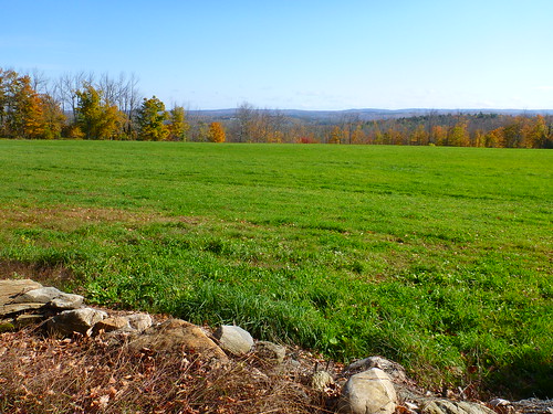
The route continued toward the northwest, mostly climbing but with some thrilling descents here and there. Much of it was along the East Branch of the Westfield River, which was gorgeous: sometimes running down cascades of rocks, at other times opening into wide shallows. I crossed Route 9, then proceeded from Windsor into Savoy, joining Route 116 for a mile or so before turning south and heading back on Route 8A. I had ridden that stretch in 2010 on a training ride; it was good to be on familiar roads. After reaching Route 9 again, I rode a mile east to the next checkpoint, arriving at 11:33 am.
I was doing well on time; my “good” time estimate had me arriving at 11:05, and my “OK” at 11:52. I made a quick peanut butter sandwich, refilled my bottle with Gatorade, and headed out as quickly as possible, less than 12 minutes after arriving. My lower back had been twinging occasionally, but it was generally fine.
Windsor to Chester Center: 21.28 miles, 1:36:17 riding time (68.43 miles total)
I was alone for the next 10 miles or so: slower than the riders who set out ahead of me, while the faster ones behind me had apparently decided to wait and regroup. It was mostly downhill, first steeply, then more gently, along the Middle Branch of the Westfield. Finally another cyclist caught up with me. He and I passed each other repeatedly: I was faster on descents, but he was faster going uphill.
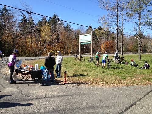
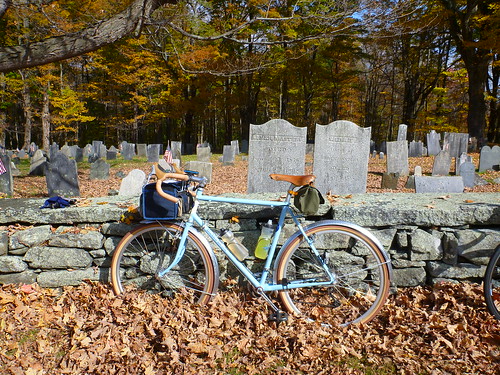
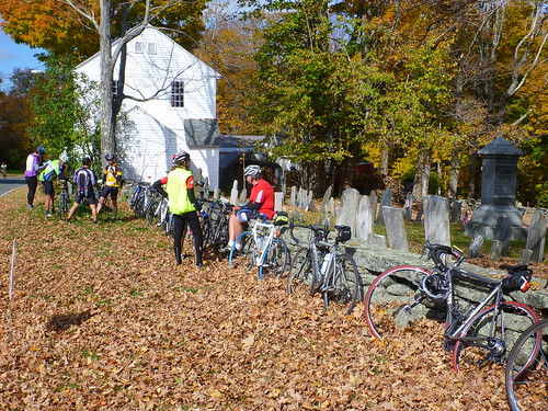
All good things must end: a 2-mile “unforgettable climb” (according to the cue sheet) brought me to the third checkpoint, the “spud stop” with hot baked potatoes, at a church parking lot across the street from a graveyard. It was 1:22 pm. My “good” time had me there by 12:45; my “OK” time by 1:50. So I was slipping a bit but still ahead of what I thought was reasonable. I had my card signed, then grabbed a potato, added butter and bacon bits, and chowed down. It was heavenly. I met another rider with a Boulder All Road; we duly admired one another’s bikes.

Chester Center to Huntington: 27.65 miles, 2:07:24 riding time (96.08 miles total)
The riders on the 100K and 85 mile rides headed east from that checkpoint, toward Westfield. We 170K riders, on the other hand, had to go west. After 19 minutes eating my spud and resting, I got back on the bike. The next 13.5 miles were grueling. There were a few downhill stretches, but we were mostly going uphill. I was going slower and slower, though not as slowly as I had in the last miles of D2R2. My lower back began to inform me that it was really unhappy.
Then, finally, the road trended downwards. In Becket, the route picked up Jacob’s Ladder Trail, a stretch of Route 20 that went slowly downhill toward Westfield, following the West Branch of the Westfield River. The wind was now blowing from the east, and it picked up, so the descent wasn’t as thrilling as it might have been. But it was downhill. That was good, because my arms, back, and legs were all tired, and the contact points where my butt met the saddle were getting increasingly sore. I was well fueled and hydrated, but ready to stop. After a nice descent, the route left Route 20 to follow side roads to the last checkpoint, fifteen miles from the end. I arrived at 3:53 pm, nearly an hour behind my “good” time but still 20 minutes ahead of the “OK” time. The stiff wind and fatigue had taken a lot out of me.
Huntington to Westfield: 15.44 miles, 1:09:12 riding time (111.51 miles total)
At the checkpoint, the Huntington Country Store, I used the portajohn and made a peanut butter sandwich, but I didn’t linger—though my GPS tells me that it was 13 minutes from arrival to departure. There was a short flat bit, a steep climb that was especially nasty after 98 miles of a 111-mile ride, and then a relatively flat ride into Westfield, trending downwards with a couple exceptions. This was the only really unpleasant stretch: it wasn’t challenging, but I had been going for over 9 hours and was ready for the riding to end. I rolled into the Sons of Erin parking lot at 5:15 pm, just 15 minutes before the hot food was scheduled to stop. My “OK” time had me there at 5:27, so I had beaten my reasonable estimate by nearly 15 minutes.
I had completed the 111.5-mile ride (according to my GPS) in 10 hours, 13 minutes total: 8 hours and 55 minutes of riding, plus 1 hour and 18 minutes off the bike for rest stops, refueling, calls of nature, and just plain stopping to take a photo and stretch. I had climbed 8,800 feet, and descended the same amount. I had beaten my “OK” pace, if not by much—I had figured on 1 hour of stopping, total, so the extra 18 minutes cut into my margin. Still, it was a great ride: I finished it, in reasonably good shape, and I could have gone on longer if necessary. And I had completed my first RUSA event within the time limit! (Here are the official RUSA results.)
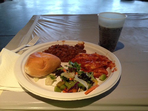
Since I had driven down to Westfield by myself, I needed to head back. I wasn’t feeling particularly social, so I grabbed a plate of chili, pasta, salad, and a roll, and washed it down with some root beer. Then I loaded up my bike on the car and headed back to Hadley. I didn’t want to deal with the Mass Pike, so I took Route 10 to Northampton, then followed Route 9 to Hillside Pizza, where I picked up the pie Jennifer had ordered. Home, a shower, and a pizza, and I was a new man. But as always when I ride more than 60 miles or so, I slept fitfully and awoke early on Monday morning. Fortunately it was a holiday, so I could go back to sleep for a bit and continue my recovery.
Post-ride reflections
I wrote most of this report about a week after the ride, when the details were still fresh in my mind. Now, reflecting on it from a month and a half later, what sticks in my mind are snatches of experience: the rushing sounds of the water at several points along the Westfield River, the good cheer of volunteers, the splendid isolation of much of my ride, brief exchanges with other riders, beautiful views of the land to the east as the road rose out of the woods. The discomfort and tedium of the last miles has faded, but not the sense of satisfaction that I felt at the end.
This was my second organized ride of the year, after D2R2 in August. The physical challenge was similar: though D2R2 was much shorter, it involved nearly as much climbing on much steeper dirt roads. My experience was quite different, though. The GRR ride was, for me, largely a solo affair. There were many fewer participants and less of a sense of camaraderie among those who weren’t there with a team. My D2R2 experience might have been different had I not spent most of the day cycling with Barry, whom I met at the start, but even so, the sheer density of cyclists on the route and at the rest stops, particularly the Green River lunch stop, gave it a festive, boisterous affair. The GRR, on the other hand, was more subdued. The volunteers at the rest stops were cheerful and helpful, and the mood was positive, but there wasn’t quite the same level of energy.
Had I made plans in advance to ride with someone, my experience might have been quite different. But I’m slow for a distance cyclist, so unless I can build up my speed, I’d need to find someone willing to keep my pace. I like long bike rides by myself, but I don’t need to participate in an organized event in order to do them. I’ve contemplated doing a 200K brevet in the spring. But maybe I’ll just plan out a nice 200K route that starts and ends at home, instead. Mount Greylock might be a good destination!