Alas, all good things must end, including my experiment using Textpattern as a CMS for this website. I’ve done almost nothing with it in years, and I don’t anticipate having more time to re-learn the program. Expect a transition to another CMS sometime soon, though exactly when depends on the current pandemic.
Changes coming...
2312 days ago
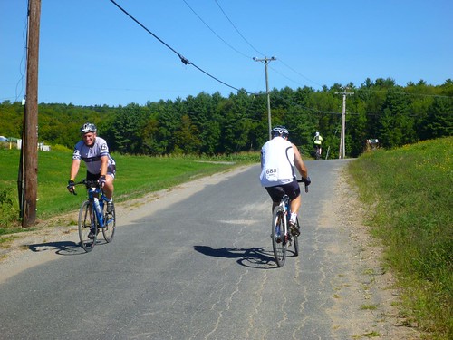
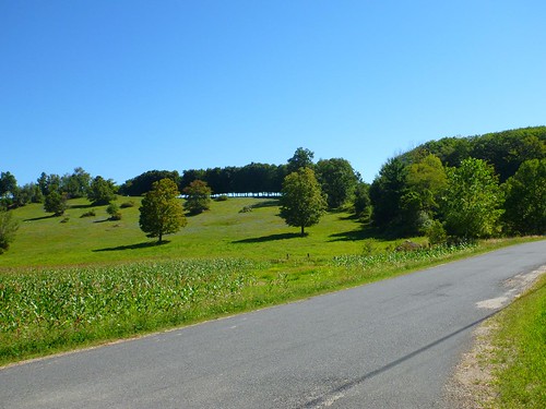
Bicycle shops in the Pioneer Valley
3953 days ago
The first installment of my guide to cycling in the Pioneer Valley. I’ve tried to include all the shops that I know. If I missed a shop, let me know! I have not visited all these shops. Shops are listed by county from north to south, then alphabetically by town. When necessary I have indicated the locality within a town (e.g. Florence, Haydenville, Turners Falls). Originally published in August 2014; most recent update September 2015.
Franklin County (north)
Greenfield
- Bicycle World, 104 Federal St, (413) 774-3701
- Bicycles & Skis Unlimited, 322 High St, (413) 772-2700
Montague
- Basically Bicycles, 88 3rd St, Turners Falls, (413) 863-3556. Specializes in recumbents and trikes but also has standard diamond frame bikes.
Sunderland
- Blue Steel Bicycle Company, 22 Amherst Rd (Route 116), (413) 665-0033 (formerly FlyeCycles). Update, January 7, 2015: Flye Cycles closed in fall 2014, and Blue Steel opened in the same space soon afterwards. I haven’t visited them yet, but I’m happy to see a new bike shop in the space.
Hampshire County (central)
Amherst
- Hampshire Bicycle Exchange, 65 University Dr, (413) 549-6575
- Laughing Dog Bicycles, 63-65 S Pleasant St (in alley), (413) 253-7722
Belchertown
- Green Light Bicycle Shop, 5 N Main St, (413) 336-7076
Easthampton
- Custom Cycle Bike Shop, 90 Cottage St, (413) 527-1009
Granby
- Peak Performance bikes, Route 202, (413) 467-2453
Hadley
- Valley Bike & Ski Werks, 173 Russell St (Route 9), (413) 582-0733
Northampton
- F. J. Rogers, 3 Main St (Route 9), Florence. (413) 584-1727. No website. Sporting goods store including bicycles.
- Full Circle Bike Shop, 141 N Main St (Route 9), Florence, (413)-585-8700
- Northampton Bicycle, 319 Pleasant St (Route 5), (413) 586-3810
Southampton
- Southampton Bicycle Center, 162 College Hwy (Route 10), (413) 527-9784
Williamsburg
- Joe’s Garage, 4 S Main St, Haydenville, (413) 268-9293. Offers Computrainer sessions in the winter.
Hampden County (south)
Agawam
- The Family Bike location in Agawam has closed; visit them in East Longmeadow.
Chicopee
- Mickey’s Bike Shop, 520 East St, (413) 592-4282
East Longmeadow
- Competitive Edge Ski & Bike, 612 N Main St, (413) 737-7495
- Family Bike, 217 Shaker Rd, (413) 525-2346
- Fit to Ride. Bicycle fitting, custom bicycles, tune-ups; by appointment only. Closed as of Sept. 27, 2015.
Holyoke
- Competitive Edge Ski & Bike, 500 Northampton St (Route 5, near Mount Tom), (413) 538-7662
- Highland Hardware and Bike Shop, 917 Hampden St, (413) 539-9314
- Holyoke Urban Bike Shop, 160 Beech St, (413) 534-5631 ×114. A “community collaborative bike shop” according to its website.
Palmer
- Palmer Pro Bike Inc., 1438 N Main St, (413) 289-1400.
Southwick
- New England Bicycle, 549 College Hwy (Route 10), (413) 569-1874
Westfield
- New Horizons Bikes, 55 Franklin St (Route 20), (413) 562-5237
West Springfield
- Colorado Ski Shop, 1160 Westfield St, (413) 746-4144. Bikes too, despite the name.
Wilbraham
- Ski-in Board and Bike, 2006 Boston Rd (Route 20), (413) 543-4980

Bicycle shops in the Pioneer Valley by Brian W. Ogilvie is licensed under a Creative Commons Attribution-NonCommercial-ShareAlike 4.0 International License.
What I did on my summer vacation
3973 days ago
I am not a faithful blogger. I’ve microblogged on Facebook, and posted some photos on my Smugmug page. I’ve written a fair amount of academic prose. But I haven’t updated this blog in nearly five months. In that time, I have:
- Ended the spring semester with no disasters.
- Attended a 65th-birthday celebration for one of my favorite historians, Tony Grafton.
- Finished drafts of two book chapters and one journal article.
- Visited Los Angeles and Pasadena, and participated in a wonderful symposium at the Huntington Library on new directions in the history of early modern science.
- Took a two-week vacation in Iceland with my wife and one of our dear friends. We are still dear friends after two weeks together, which wasn’t a given! I’m still finishing the photos, but a selection from all but the last two days is available here.
- Rode D2R2, the Deerfield Dirt Road Randonnée, for the third year in a row. This time I rode to the start, did the 115K route to the lunch stop, and then did my own variation on the 100K route back to the finish. After a snack, I rode back home. My mix-and-match version had less climbing than the official routes, but I compensated by 28 miles riding from my house to the start/finish and then back again.
- Visited Montreal to see some friends, stopping at Middlebury, Vermont, on the way back to see more friends from the days we lived there.
- Went on long (and short) bike rides, did some hikes, went paddling, ran here and there, sat in the back yard sipping G&Ts, and generally enjoyed summer in western Massachusetts while making some progress on a number of projects, even if I would have liked to have accomplished even more.
It was nice to spend the summer mostly at home, with scarcely a month, in toto, elsewhere. Next summer we’ll be in Zürich in early June, and Oxford in mid-July, with some time in France in between, and perhaps a bike tour in Turkey before Zürich. It will be fun to travel, but I’m sure I’ll look back longingly on a summer spent at home.
I raced my first 5K today and beat my goal time! (I think...)
4122 days ago
I got back into running last year for fitness, not for racing. But when I found out about the UMass 5K Dash & Dine race, organized by UMass’s Dining Services, I decided to sign up. It’s a benefit for the Amherst Survival Center, which provides meals, food, and social and legal services for people in Amherst and the surrounding towns. And I figured that having a race on my schedule would help structure my running and give me something to work towards.
I’ve run only one race before, and that was in May 1995: the 25K River Bank Run in Grand Rapids, Michigan. Due to a foot injury that affected my training, I didn’t run that very hard, finishing in 2:03:06 (i.e. a 7:55/minute pace). I wanted to push myself harder on this one, despite being two decades older, especially since a 5K is fairly short in comparison.
It was a good race. The temperature was around 50°F, but there were winds from the WNW at 15-20 mph. Fortunately they were at my back for the two steep uphill parts of the race. I arrived about 45 minutes in advance, got my bib, bought some raffle tickets, and went for a leisurely mile and a half warmup run. By the time I finished that, it was time to take a last-minute pit stop and then line up for the start. I was a little bit behind a runner in a Gumby costume. I couldn’t see most of him, but his calves suggested that he was a serious runner.
The race itself
The start was muddled up; it was a mass start, with runners grouped by their goal pace, and a bit crowded, but the real problem was that a runner next to me dropped his cell phone right at the start, which led to some jostling that nearly made me lose my balance and fall. But I recovered. I also pressed the “stop” button on my watch, not the “lap” button, as I crossed the starting line/pad. I figured that out perhaps 30 seconds later, but it meant that my GPS track omitted a bit of the actual run and that my watch timing was off.
I had expected that an event with up to 2000 participants would mean that the campus roads we followed would be closed, but in a university the size of a small town, that apparently wasn’t possible. We ran on wide asphalt sidewalks (occasionally some concrete) and had to be careful with curbs at intersections. And for the first mile or so, it was difficult to weave among the slower runners. I kept my eyes on Gumby and did my best to keep pace with him. I did the first recorded mile at a 7:28 pace—not too bad given the crowding and the climb.
In the second mile, the crowd thinned out as I found myself among runners with a similar pace. The course descended gradually for a while, and I was able to run a 6:57 mile without too much suffering. Around the halfway mark I passed Gumby; I wouldn’t see him again until the finish. Mile three, on the other hand, had a steep uphill stretch—not very long, only a sixth of a mile, and the wind was mostly at my back, but it was followed by a more gradual uphill section. I’m glad that I kept some oomph in reserve; I was passing other runners by the end of the climb. And then it was a flat stretch, with a slight dip into a tunnel, to the finish line. The clock read something around 21:55 as I crossed the line. (Update: My official gun time was 21:50.8, and my net time was 21:43.9, since it took me 6.9 seconds to reach the starting line. Results here.) Gumby showed up a short time later. I can’t feel too good about beating him, though, since I wasn’t running in a stuffy foam costume.
My finishing time put me in 73rd place overall, out of 788, and fourth out of 29 in my division (Male 40-55). Not too shabby, if I say so myself, though it is a local race!
After the race
Though I had finished the race, I still wanted my GPS watch to have recorded 5K despite the bit at the beginning I missed, so I continued past the finish for 0.06 miles before pressing stop on my watch. Yes, I am that nerdy. Then I walked back to the finish, slurped down a glass of water, and—what else?—started running again for a brief cooldown. A mile at an 8:10 pace seemed pretty easy after the last 2.11 miles of the race. I ended at my car, where I got my phone and raffle tickets and headed up to the Berkshire Dining Commons for lunch.
Lunch was good, but the DC was very crowded and I couldn’t find a place to sit. I had a pita paneer sandwich, a chicken breast, and some fries—potato and sweet potato—and then called my wife, who was on campus for an event. We agreed to meet up at the tunnel through which I had run as I approached the finish. On the way, I stopped at the raffle table and discovered that I had won a gift basket from Peet’s Coffee and Tea, with two mugs and assorted packages of Peet’s products. This might be the first time in my life I’ve won a raffle prize!
Thoughts about the race and the event
I had a lot of fun running the race, despite the start. I pushed myself, but I didn’t start out too hard and burn out. I could probably have pushed a bit more, but my point was to challenge myself while still having fun, not to have a miserable experience. I definitely beat the 22:37 5K segment that I had run during a 7K run last December. My training runs have shown me that I speed up after the first mile or two, which is why I did a 1.5-mile warmup before the race.
The event was festive, with music playing and (mercifully brief) opening remarks by Chancellor Kumble Subbaswamy and State Senator Stan Rosenberg. My only complaint involves logistical information. Maybe people who registered in person found out more, but I registered online and received no information about where and when to pick up my bib and timing chip, who was timing the race and whether unofficial times would be live online, how the start would be organized, how the costume contest worked, and whether the course would be closed to vehicles. I had to email an organizer to find out when bibs could be picked up, and I still don’t yet know where the official times will be posted (see the update above for my time, found via DuckDuckGo). The only detailed information online, apart from the start time and place, was the course route and the parking lots to use. I’m going to suggest that the organizers add a logistics page for participants to next year’s website.
Spring "break" is here!
4150 days ago
The last couple months have been a blur. I’m teaching a lecture course, Western Thought to 1500, that I haven’t done since 2007. That has required refreshing myself on the material and updating some of the lectures and assignments. My other course is a small seminar for grad students and honors undergraduates on witchcraft, magic, and science in medieval and early modern Europe. That’s fun but does require going over assigned readings carefully and responding to students’ work.
Then there were the job searches—we had two searches in my department, and while I wasn’t on either committee, I had to meet the candidates, go to their talks, and participate in the department discussions and votes. And for my sins, I’m on a committee this year for a faculty position in German Studies; though I didn’t attend the MLA convention for first-round interviews, I attended the finalists’ sample classes (each taught one class in an Intermediate Advanced German course), went to their talks, and went to dinner with them.
Add to that the work on the college’s personnel committee, Faculty Senate, Research Library Council, and a few other things, plus the writing that I’ve been cramming into spare minutes here and there, and you’ll understand why I am happy that our spring break has arrived.
So what am I doing? Jetting off to Berlin, where my wife and I have booked a flat. I have a conference there, and before that starts, I’ll be spending some time each day writing and then going to see how the city has changed in the twelve years since my last visit. And of course immersing myself again in Berlin café culture, even though the best part of it, sitting in a garden along one of the city’s many canals, might not yet be an option.
I have been keeping up my running, and doing some stationary cycling (though not as much as I had planned). And just this week, I have gotten back on the bike outside, commuting to work on Wednesday and Thursday and then taking a 20-mile ride up to Leverett yesterday. I might rent a bike for a ride or two in Berlin, and I’ll definitely be running there. It will be slightly warmer there than at home, with highs in the 50’s (Fahrenheit) and lows above freezing most of the time.
I’ll be taking some students’ papers with me, and of course my writing projects, so this really isn’t a break. But it will be a break in the routine. Wenn nur mein gesprochenes Deutsch ein bisschen besser wäre…. (And I’m still unconvinced about the latest spelling reforms that turned “daß” and “bißchen” into “dass” and “bisschen.”)
Two years ago...
4216 days ago
In January 2013, I decided it was finally time to get rid of the excess weight I had been carrying for quite some time. Exercise and eating sensible foods weren’t working by themselves, so I decided that I needed a method. While visiting my sister, I saw that Consumer Reports had a review of weight loss programs and had a good review of the free MyFitnessPal.com site, which emphasizes calorie counting (with social network features, since this was 2013…).
Two years ago today, Jan. 7, 2013, I signed up and started counting my calories carefully. After the first year, I had lost nearly 47 pounds (over 21 kg, or 3 stone 5 lb.) and was back to what I weighed in 1999. After two years, I have lost another 17 pounds (7.7 kg, or 1 stone 3 lb.), for a total weight loss of 64 lb. (29 kg, or 4 stone 8 lb.). I weigh less than I did in 1997.
I’ll probably never get back to my all-time lowest adult weight, which was about 130 lb., some time in the early 1990s. Back then I was swimming three times a week for 45 minutes to an hour, usually the crawl, and occasionally running a bit. (It’s possible that I weighed slightly more, if the scale in the pool locker room was off.) By the time I got married I was running instead of swimming and had put some muscle on my legs, so I was around 137. I’m not likely to get that low again in my late 40s or 50s. Strangely enough, as I have lost weight this time around, my hands have retained some of their fat, so my wedding ring is still too small to remove. Since I’m not likely to lose much more weight, I’ll probably get it resized this summer.
Having reached a healthy weight and body fat percentage, I’m not going to worry too much about scale weight in the future. I want to avoid gaining much more fat, to preserve lean body mass through exercise (particularly strength training), and to continue to develop speed, power, and endurance on the bike and in running. For those goals, the scale is less useful. I’ll continue to keep an eye on it, though; having slowly gained over 60 pounds from 1996 to 2008, I would like to avoid a repeat.
Looking back on 2014: Health and fitness
4222 days ago
2014 was a pretty good year for me in terms of staying active and getting my weight under control. I didn’t do as much cycling this year as I did last, but I took up running again. I pushed things too far in late April and early May, exacerbating a 2012 injury to an area below and outside my right knee, where the fibula ends, so I had to take a couple months off of running, but that’s now under control.
Physical activity
A summary of this year’s activity:
| Activity | Distance | Time | Weekly average | ||
|---|---|---|---|---|---|
| Cycling | 3,204 miles | 236h 10m | 4h 33m | ||
| – on rollers/stationary bike | 402 miles | ||||
| Running | 364 miles | 52h 54m | 1h 1m | ||
| Walking/hiking | 262 miles | 90h 30m | 1h 44m | ||
| Canoeing and erg rowing | 88417 m (55 miles) | 12h 33m | 15m | ||
| Cross-country skiing | 14 miles | 6h 21m | 7m | ||
| Strength training | 28h 59m | 33 m | |||
| TOTAL | 4301 miles | 427h 27m =17d 19h 27m |
8h 13m |
My longest bike ride was only 82 miles, a hilly ride (6,716 feet of climbing) that I did in preparation for D2R2 the following week. My D2R2 ride was shorter, only 77 miles, but featured 7,566 feet of climbing. My longest run, on the other hand, was only 6.5 miles.
I didn’t do that much strength training, mostly bodyweight exercises to help preserve lean muscle mass as I lost fat. That’s an area on which to focus in 2015.
Weight loss
After losing 47 pounds in 2013, I took off another 18 in 2014, most of it in the first eight months of the year. I’ve reached a reasonable weight for my height and build and will focus on not regaining weight. I joined the National Weight Control Registry, so that my experience can be used for ongoing research into weight loss.
Health
I’ve been pretty healthy this year: a couple of colds, and one upper respiratory illness that might have been strep throat in early spring, but no major illnesses or injuries. I did reactivate my February 2012 cycling injury by running too much and too far in the spring, not helped by all the standing and slow walking that came with graduation events. And I lost a tooth to an olive pit in September.
Looking forward
I’ll be taking a week off of physical activity this month when I have a sinus lift and dental implant to replace the molar that I lost in the fall. It’s probably not a bad idea to take a week off anyway, and I’ll need rest as I recover from surgery.
Barring any new injuries, I plan to keep running regularly, three times a week for a total of 15-20 miles. I’ve decided to do the UMass 5K Dash and Dine race on April 11, which will give me about 12 weeks to train once I’ve recovered from surgery. I might run more often when I’m traveling for work, since it’s easier to pack running shoes and shorts than a bicycle!
I’ll continue to cycle regularly, too. My travel plans for the summer are still up in the air, but I imagine I’ll be back in western Massachusetts in time for this year’s D2R2 on August 22. Presuming that I have time to train adequately, I’ll tackle the 115K again. I’m not sure I’ll do any other organized rides, though I might do a few Wednesday night rides with the Northampton Cycling Club if I’m around.
Now that we have a canoe and a roof carrier, I expect that we’ll try to work in a few days of paddling every month once the spring melt comes. That, in turn, will probably mean fewer bike rides, so I’ll aim to do a couple of shorter rides during the week and then one long ride on the weekend.
I’m also going to make a habit of hiking the 2-mile loop trail at the Mount Warner Reservation that opened last fall. My family gave us snowshoes for Christmas, so I might even give it a try in the snow, either by myself or on the hot chocolate snowshoe hike in a few weeks. I’d like to make a point of hiking more regularly elsewhere, too.
I enjoy seeing improvements in my strength and endurance, especially cycling and running faster and farther. But I don’t have much of an urge to compete against others. I’d rather be a good all-around athlete, someone who can go for a long hike or tromp around a city all day without getting fatigued, than a competitive cyclist or runner. I might enter a couple of running races, just for the experience of participating with hundreds of others. That was the enjoyable part of the 25K River Bank Run I did back in 1995 (my first, and to date only, organized race). I don’t see myself cycle racing. I can imagine doing more randonneuring, perhaps a 200K and 300K brevet in the fall or in spring 2016. It’s a sport in which everyone who finishes the distance within the allotted time is a winner. That’s my style!
Mostly, though, as I approach my fifth decade, I want to do fun stuff outdoors in a way that will help me preserve my mobility and independence for decades to come. The one weak spot in my routine is strength training: I should add a little more every week, probably bodyweight exercises that are easy to do when traveling. I don’t want to end up looking like the cyclists in Les Triplettes de Belleville!
Organized bike rides in the Pioneer Valley (and beyond)
4366 days ago
I have given the next dates for these events when I know them; otherwise, I indicate the most recent date. The town where they start and end is indicated in parentheses. Rides are listed chronologically; note that some rides move between the last week of one month and the first week of the next, depending on when the weekend falls.
Most websites provide route maps or cue sheets for the rides, so they can provide useful suggestions for routes to follow even if you don’t want to participate in the organized event.
If you know of a ride that I have not listed, please let me know!
2014-09-08: Updated to include the Pedal Poker Run on Oct. 12.
March (and through September)
Berkshire Brevets series (Westfield): A series of rides from 100 to 600 km, sanctioned by Randonneurs USA and, in some cases, by the Audax Club Parisien. The traditional 100 km Populaire is held St. Patrick’s Day weekend, with the Super Randonneur series from early April through June. Details are posted on the New Horizons Bikes website.
May
Katelynn’s Ride (Amherst), Sunday, May 31, 2015. A charity ride for several children’s cancer organizations. Rides of 10, 25, 50, and 100 miles.
June
Steph’s Wild Ride (Northampton), Saturday, June 7, 2014. A charity ride that raises funds to assist families of children with cancer in the Valley. 25-mile and metric century (100 km/62 mile) options. There’s a motorcycle version, too, bringing together two groups of two-wheeled enthusiasts.
King’s Tour of the Quabbin (Rutland), Sunday, June 8, 2014. Not strictly speaking a ride that starts in the Pioneer Valley, but the ride around the Quabbin Reservoir brings riders into the Valley. Rides of 62, 100, and 125 miles.
July
JAM Grand Fundo/Grand Hundo (Southampton), Saturday, July 19, 2014. Fundraiser for the JAM Fund, which provides grants for cyclists under 25 years old. The Grand Fundo ride is 64 miles; in 2014 other options included the 38-mile Mini Fundo and the 84-mile Grand Hundo. Rides are challenging for their length, with substantial climbing and some nasty hills: the Fundo gains 5300 feet and the Hundo, 7600.
August
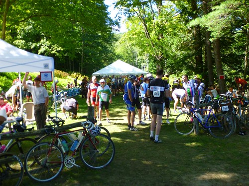
D2R2 – the Deerfield Dirt Road Randonnée (Deerfield), Saturday, Aug. 23, 2014. A benefit for the Franklin Land Trust, D2R2 involves rides from 100 km (62 miles) to 180 km (112 miles) on the challenging dirt roads of Franklin County and southern Vermont. There’s also a 40-mile family Green River Tour, which follows the mostly flat Green River Road (also dirt). Registration for the randonnées is capped at 1,000 riders total.
Wheeling for Healing Bike Ride (Greenfield), Sunday, Aug. 24, 2014. Fundraiser for Baystate Health Foundation. Rides of 3, 10, 25, and 50 miles. The 25-mile ride has some hills; the 50-miler, many.
September
Connecticut Valley Century (COVAC) Benefit Bike Ride (Hatfield), Sunday, Sept. 7, 2014. Proceeds benefit the Amherst Rotary Club’s Good Works Fund. Rides of 25, 50, 75, and 100 miles, mostly flat.
BikeFest and Tour of the Valley (Florence/Northampton), Saturday, Sept. 20, 2014. Organized by the Northampton Cycling Club. Ride options: 8, 25, 45, 72, and 104 miles. The longer rides involve a challenging amount of climbing.
Will Bike 4 Food (Hatfield), Sunday, Sept. 28, 2014. Charity ride for the Food Bank of Western Massachusetts. Rides of 10, 25, 50, and 100 miles. The longer rides are hilly.
October
Sunderland Clover Century (Sunderland), October 4, 2014. Rides of 25, 50, 75, and 100 miles, arranged so that there are four 25-mile loops that start and end in town. Riders can mix and match loops for rides up to 100 miles. Organized in conjunction with the town’s annual fall festival; information is usually posted sometime in late August or September.
Great River Ride (Westfield), Sunday, October 12, 2014. Rides of 15, 25, 35, 62, 85, 111, and 125 miles (more options than in the past), along the different branches of the Westfield River. The longer rides are challenging (the 111-mile ride last year involved 8,800 feet of climbing). The longer distances are RUSA-sanctioned Populaires; new for 2014 is an ACP-sanctioned 200K brevet.
4th annual Pedal Poker Run (Northampton), Sunday, October 12, 2014. 10- and 50-mile rides. Charity event supporting Valley CDC. Participants draw five cards over the course of the ride, with prizes for the best poker hands.
Organized bike rides in the Pioneer Valley by Brian W. Ogilvie is licensed under a Creative Commons Attribution-NonCommercial-ShareAlike 4.0 International License.
June cycling summary
4406 days ago
Wow. I spent a lot of time on my bike in June. 634.2 miles total (1020.7 km), in 47 hours, 52 minutes, with 23,360 feet of climbing. No wonder my legs feel tired! I’ve explored plenty of new roads, as well as some old favorites, and done a few Wednesday night rides with the Northampton Cycling Club’s C group.
With all the travel I’m doing in July, I won’t be riding nearly as much, but I should have a good base for tackling D2R2 on August 23. Fingers crossed….
A bike ride up to Conway, June 27, 2014
4409 days ago
Jennifer and I took off a bit of Friday afternoon to do a 42.75-mile ride up to Conway and back. I took a camera and put together a photo album of the ride. The photo titles and captions tell most of the story.
From our house, we rode up to Stockwell, down Route 47 and North Lane to the Hadley Common, then took the Norwottuck and Northampton bike trails to Look Park and Leeds. Then we took Audubon Road/South Street to Williamsburg, then Nash Hill Road to Whately Road (partially closed, but passable to bikes) to the Northampton Reservoir. Thence we rode north to Conway and back to South Deerfield on 116. After creemees in the village, we took Sugarloaf St. to 116, back to 47, and then around Mount Warner on Stockbridge and Maple. The complete route map is available on Strava.
Crazy busy spring
4496 days ago
I expected spring to be busy, but not quite this busy. Teaching a new course (World History since 1500—nothing too temerarious!), chairing my department personnel committee, and spending two weeks in Europe for lectures and presentations, followed by a weekend conference, didn’t help any. And I took up running again.
The upshot is that doing things has taken precedence over blogging them. But I did want to note that I did my first club bike ride today, the C ride with the Northampton Cycling Club. It was fun, though not much of a challenge at this stage of the season (since I did a lot of cycling on rollers over the winter, and took up running). My travel and conference schedule has meant that I couldn’t do the Berkshire Brevets 100K or 200K this spring. But I’ve registered for the D2R2 115K in August, and I plan to repeat the Great River Ride in October, so I need to get in some long rides. If I do the C rides, plus the 15-mile round trip from my home to the Academy of Music, that should get me in shape!
Thoughts on the first day of 2014
4587 days ago
Thanks-giving
Thanks to my family and friends for their love and support. Especially Jennifer, sine qua non, and the rest of the Heuers, Ogilvies, and Ebys.
Thanks to my students, who keep me on my toes, and make me connect my research interests to big historical questions.
Thanks to my colleagues, who remind me that it’s worthwhile to devote some of my energies to a relatively narrow set of problems that interest a smart, learned group of scholars.
Thanks to my bicycles for allowing me to explore and enjoy the New England countryside, and to the D2R2 and Great River Ride organizers for putting together such fun events.
Regrets
Between multiple illnesses (flu, nasty colds – nothing too bad) and taking on too much, I am behind on some of my professional commitments (a book MS, book reviews, articles, reports, etc.). I apologize to all of you who are affected, and I’ll be in touch in the next week to negotiate new deadlines. Mea maxima culpa.
Future
I’ve lost 45 pounds in the last year. I hope to take off a few more this year, and then avoid gaining them back.
I have several open writing projects (see “Regrets,” above). I want to finish them, and avoid taking on more than I can handle in the future. I got a fair amount done in 2013, including three new book chapters, but it was touch and go too much of the time. More time for contemplation would be a big help.
I’ll be traveling to France and England in March for a lecture and a working group meeting, and the Netherlands in May for a symposium on Maria Sibylla Merian. The rest of my travels are up in the air, but I hope to visit some interesting places and bicycle through them.
And finally, I hope to spend more time in 2014 doing and experiencing things, and less time reflecting on them. Metacognition is useful, within limits, but it can also devolve into navel-gazing. My navel isn’t particularly attractive, so I should focus elsewhere.
I hope that you all have a great 2014, and if anyone is reading this and just wants to say hi, feel free to leave a comment!
2013 Great River Ride report - 170K RUSA Populaire
4618 days ago
On Sunday, October 13, I participated in the Great River Ride, an event that starts and ends at the Sons of Erin in Westfield, Massachusetts. Organized by New Horizons Bikes, the GRR offers rides from 35 to 109 (really 111) miles. I signed up for the longest, choosing the option of riding it as a 170K “populaire” sanctioned by Randonneurs USA (RUSA).
This was the third RUSA event I had signed up for since joining the organization in 2010. I had signed up for a 200K brevet that spring, but ended up not riding because I hurt my leg a few days before it—getting out of bed in the morning! (A sign I am no longer young.) I did 200K the following weekend, but not as an approved event. Then in fall 2012 I signed up for the 100K populaire (62 mile) version of the Great River Ride, and started it, but a mechanical failure early on led me to shorten the course to only 28 miles or so.
This summer I had done a century in June (the 100 Miles of Nowhere), the 100K version of D2R2 in August, and had ridden 100 miles per week, on average, since mid-April. I was still not sure about the 170K GRR, which has nearly 9,000 feet of climbing in the Berkshires. But there were a couple points where I could bail out and do a relatively short ride back to Westfield, so I thought I’d give it my best shot.
Getting started
The populaire was scheduled to begin at 7 am, so I was up at 5:30 and on the road, a cup of coffee in hand, a little after 6. The drive to the Sons of Erin was uneventful; I was there by 6:50, quickly got my bike ready, and then signed my waiver and got my ride card. The volunteer working the registration remembered my name, even though I had done the ride only once before! (I suspect she may be on the listserv for the Pioneer Valley chapter of MassBike, in which case she might have seen my name and Gmail profile picture on a couple of recent posts.) I needed to dash back to the car to drop off the commemorative water bottle that I got for registering early, so it was 7:03 when I hit start on my GPS and rolled out of the parking lot. It was about 45 degrees Fahrenheit; I was wearing bib shorts, a light long-sleeved wool jersey, and a light jacket.
The rules of randonneuring require that rides be completed within a set time; each of the four checkpoints had an opening and closing time, and there was an overall limit of 11 hours and 20 minutes to complete the course, including stops. I had looked at the course profile and calculated how long it would take me to get to each checkpoint if I were having a great day, if I were riding at an average pace, and if things went south. I didn’t want to start out too strong, which was nearly my ruin in the 100 Miles of Nowhere. I figured that I should be able to do the entire ride well within the time limit, as long as my endurance didn’t give out.
Westfield to Worthington: 26.74 miles, 2:19:55 riding time
The first checkpoint was 27 miles down the road. Getting there required a little flat riding, then a long, steep climb where last year I had sheared off the bolts that held my small chainring to the crank. This time I made it up without any problem, though I stopped at the bottom of the hill to take off my jacket, figuring I would heat up during the climb. I was right, though I later lost that heat on a descent.
The long slog uphill elevated my heartbeat and my body temperature. It was even worse than I remembered, probably because the previous time I had done it, I took an involuntary break partway up. Still, it ended; then there was a flat bit through Montgomery and then a long descent to Route 112 in Huntington. I hit 41 mph on the steepest downhill bit, then feathered my brakes as I entered a twisty stretch of road. At one point I was passed by an idiot cyclist who must have been doing 50 mph. Another rider and I commented on his idiocy when we reached the flat.
Another 13 miles north on Route 112, climbing slowly with a few steep bits. I stopped at one point to put my jacket back on. Then I reached the first checkpoint, pulling in at 9:28 am. My “good” time had me here at 9:17, and my “OK” time at 9:47, so I was doing pretty well.
I had my ride card signed with the time, then scarfed down a couple mini bagels with peanut butter and cream cheese, filled my water bottle with Gatorade powder and water, grabbed a cup of coffee at the country store across from the checkpoint, and stood in line for the porta-john. Twenty-four minutes later, I rolled out toward the north. I had spent 9 more minutes at the checkpoint than I had planned, but I was still on schedule.
Worthington to Windsor: 20.41 miles, 1:41:15 riding time (47.15 miles total)
The route continued toward the northwest, mostly climbing but with some thrilling descents here and there. Much of it was along the East Branch of the Westfield River, which was gorgeous: sometimes running down cascades of rocks, at other times opening into wide shallows. I crossed Route 9, then proceeded from Windsor into Savoy, joining Route 116 for a mile or so before turning south and heading back on Route 8A. I had ridden that stretch in 2010 on a training ride; it was good to be on familiar roads. After reaching Route 9 again, I rode a mile east to the next checkpoint, arriving at 11:33 am.
I was doing well on time; my “good” time estimate had me arriving at 11:05, and my “OK” at 11:52. I made a quick peanut butter sandwich, refilled my bottle with Gatorade, and headed out as quickly as possible, less than 12 minutes after arriving. My lower back had been twinging occasionally, but it was generally fine.
Windsor to Chester Center: 21.28 miles, 1:36:17 riding time (68.43 miles total)
I was alone for the next 10 miles or so: slower than the riders who set out ahead of me, while the faster ones behind me had apparently decided to wait and regroup. It was mostly downhill, first steeply, then more gently, along the Middle Branch of the Westfield. Finally another cyclist caught up with me. He and I passed each other repeatedly: I was faster on descents, but he was faster going uphill.
All good things must end: a 2-mile “unforgettable climb” (according to the cue sheet) brought me to the third checkpoint, the “spud stop” with hot baked potatoes, at a church parking lot across the street from a graveyard. It was 1:22 pm. My “good” time had me there by 12:45; my “OK” time by 1:50. So I was slipping a bit but still ahead of what I thought was reasonable. I had my card signed, then grabbed a potato, added butter and bacon bits, and chowed down. It was heavenly. I met another rider with a Boulder All Road; we duly admired one another’s bikes.

Chester Center to Huntington: 27.65 miles, 2:07:24 riding time (96.08 miles total)
The riders on the 100K and 85 mile rides headed east from that checkpoint, toward Westfield. We 170K riders, on the other hand, had to go west. After 19 minutes eating my spud and resting, I got back on the bike. The next 13.5 miles were grueling. There were a few downhill stretches, but we were mostly going uphill. I was going slower and slower, though not as slowly as I had in the last miles of D2R2. My lower back began to inform me that it was really unhappy.
Then, finally, the road trended downwards. In Becket, the route picked up Jacob’s Ladder Trail, a stretch of Route 20 that went slowly downhill toward Westfield, following the West Branch of the Westfield River. The wind was now blowing from the east, and it picked up, so the descent wasn’t as thrilling as it might have been. But it was downhill. That was good, because my arms, back, and legs were all tired, and the contact points where my butt met the saddle were getting increasingly sore. I was well fueled and hydrated, but ready to stop. After a nice descent, the route left Route 20 to follow side roads to the last checkpoint, fifteen miles from the end. I arrived at 3:53 pm, nearly an hour behind my “good” time but still 20 minutes ahead of the “OK” time. The stiff wind and fatigue had taken a lot out of me.
Huntington to Westfield: 15.44 miles, 1:09:12 riding time (111.51 miles total)
At the checkpoint, the Huntington Country Store, I used the portajohn and made a peanut butter sandwich, but I didn’t linger—though my GPS tells me that it was 13 minutes from arrival to departure. There was a short flat bit, a steep climb that was especially nasty after 98 miles of a 111-mile ride, and then a relatively flat ride into Westfield, trending downwards with a couple exceptions. This was the only really unpleasant stretch: it wasn’t challenging, but I had been going for over 9 hours and was ready for the riding to end. I rolled into the Sons of Erin parking lot at 5:15 pm, just 15 minutes before the hot food was scheduled to stop. My “OK” time had me there at 5:27, so I had beaten my reasonable estimate by nearly 15 minutes.
I had completed the 111.5-mile ride (according to my GPS) in 10 hours, 13 minutes total: 8 hours and 55 minutes of riding, plus 1 hour and 18 minutes off the bike for rest stops, refueling, calls of nature, and just plain stopping to take a photo and stretch. I had climbed 8,800 feet, and descended the same amount. I had beaten my “OK” pace, if not by much—I had figured on 1 hour of stopping, total, so the extra 18 minutes cut into my margin. Still, it was a great ride: I finished it, in reasonably good shape, and I could have gone on longer if necessary. And I had completed my first RUSA event within the time limit! (Here are the official RUSA results.)
Since I had driven down to Westfield by myself, I needed to head back. I wasn’t feeling particularly social, so I grabbed a plate of chili, pasta, salad, and a roll, and washed it down with some root beer. Then I loaded up my bike on the car and headed back to Hadley. I didn’t want to deal with the Mass Pike, so I took Route 10 to Northampton, then followed Route 9 to Hillside Pizza, where I picked up the pie Jennifer had ordered. Home, a shower, and a pizza, and I was a new man. But as always when I ride more than 60 miles or so, I slept fitfully and awoke early on Monday morning. Fortunately it was a holiday, so I could go back to sleep for a bit and continue my recovery.
Post-ride reflections
I wrote most of this report about a week after the ride, when the details were still fresh in my mind. Now, reflecting on it from a month and a half later, what sticks in my mind are snatches of experience: the rushing sounds of the water at several points along the Westfield River, the good cheer of volunteers, the splendid isolation of much of my ride, brief exchanges with other riders, beautiful views of the land to the east as the road rose out of the woods. The discomfort and tedium of the last miles has faded, but not the sense of satisfaction that I felt at the end.
This was my second organized ride of the year, after D2R2 in August. The physical challenge was similar: though D2R2 was much shorter, it involved nearly as much climbing on much steeper dirt roads. My experience was quite different, though. The GRR ride was, for me, largely a solo affair. There were many fewer participants and less of a sense of camaraderie among those who weren’t there with a team. My D2R2 experience might have been different had I not spent most of the day cycling with Barry, whom I met at the start, but even so, the sheer density of cyclists on the route and at the rest stops, particularly the Green River lunch stop, gave it a festive, boisterous affair. The GRR, on the other hand, was more subdued. The volunteers at the rest stops were cheerful and helpful, and the mood was positive, but there wasn’t quite the same level of energy.
Had I made plans in advance to ride with someone, my experience might have been quite different. But I’m slow for a distance cyclist, so unless I can build up my speed, I’d need to find someone willing to keep my pace. I like long bike rides by myself, but I don’t need to participate in an organized event in order to do them. I’ve contemplated doing a 200K brevet in the spring. But maybe I’ll just plan out a nice 200K route that starts and ends at home, instead. Mount Greylock might be a good destination!
D2R2 photos by others
4715 days ago
Robert Kerner, one of the other cyclists at D2R2 got a shot at the lunch stop with me and my bike in the center of the frame. Here it is (linked back to his Flickr account):

Photo copyright © 2013 Robert Kerner; linked to Flickr.
If I run across any other neat photos, I’ll update this post.
D2R2 ride report 2013 - the 100K edition
4716 days ago
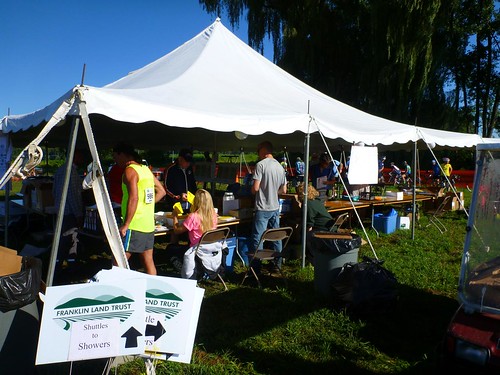
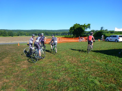
Yesterday (Saturday, August 24) I participated for the first time in D2R2, the Deerfield Dirt Road Randonnée. D2R2 is a cycling event exploring the dirt roads of Franklin County, Massachusetts, and southern Windham County, Vermont. There are several versions of the ride: 100K, 115K, 150K, and 180K. What characterizes them all is that they are extremely difficult for the distances involved. Dirt roads in this area generally rise from the river valleys, whose roads are paved, up into the hills. Some of them barely count as improved roads (Old Albany Road, Hawks Road, and stretches of Franklin Hill Road, I’m thinking of you). They are often quite steep and generally eschew switchbacks. The ride designer, Sandy Whittlesey, had this to say about the course. The organizers, the Franklin Land Trust, also offer a 40-mile Green River Tour for cyclists who want to see some of the area’s natural beauty while avoiding strenuous climbs.
I had initially signed up for the 115K course, which has around 9,000 feet of climbing, but a few weeks before the event I did a frank assessment of my preparation and decided to switch to the 100K. D2R2 organizers are cool with switching, even the day of the event; some riders mix and match parts of the rides, which all converge on the Green River Covered Bridge in Guilford, Vt. (The 150K has its first rest stop there; for the other rides, it’s the lunch site.) With “only” 7,800 feet of climbing, the 100K seemed more my style. An additional advantage was that the 100K started an hour later than the 115K, at 9 am; since Jennifer kindly agreed to drop me off at the start, that let us both get a little more sleep.
This is a long post. The brief version: it was a great ride, challenging but not draining, on a beautiful day through gorgeous countryside. The event was carefully organized and the volunteers were cheerful and efficient. I’ll be back! If you want to skip my narrative, you can jump to my post-ride reflections.
The day of the ride
The weather was gorgeous: clear skies, low humidity, cool in the morning, and little wind. It was in the low 60s F at the starting point in Deerfield, with highs forecast for the 70s. Hard to imagine better cycling weather! I had prepared my bike and gear the night before: tires inflated, brakes checked, chain lubed, bottles filled, tools and spare parts packed, and some emergency food ready. (Since the ride literally did not pass a single food or convenience store, the checkpoints provided food, but I wanted to be prepared in case I needed more or had a breakdown.) I had a light breakfast, a slice of toast and coffee.
Jennifer dropped me off at the starting point, a big field south of Historic Deerfield, around 8:30. I set up my bike, picked up my registration packet, attached my ride number and electronic chip to my jersey and helmet, and grabbed a bagel and some cream cheese for breakfast #2, along with a cup of hot water to take off a bit of the chill; I was wearing a lightweight, short-sleeved wool jersey, but figured that I’d warm up once the ride started. I milled around a bit, admiring some of the bikes; others, in turn, admired my Boulder All Road.
In the ride report below, I’m indicating distances and climbing based on what my GPS read. They differ somewhat from the cue sheets provided by the organizers, which claimed 62.7 miles and 7800 feet of total climbing.
From Deerfield to the Little Big House: 13.3 miles, 2126 feet of climbing
At exactly 9 am, I started my computer/GPS and rolled through the starting gate. D2R2 isn’t finicky about starts; some riders started earlier, others later. The gate computer should have read my electronic chip, though I don’t recall hearing it beep. We turned south along Mill Village Road. I was riding along with a couple of others, Barry from Worcester and Patrick from Franklin, MA. Patrick had a helmet camera that took a picture every 30 seconds. He was planning to edit the ride down to a slide show, though he admitted that looking at someone’s ride record was even worse than watching vacation slides.
[2013-08-27: The narrative has been corrected in light of Patrick’s comment, below. I had originally identified the rider with the helmet cam to whom I spoke as being from New York City; I misremembered.]
At the first short hill, Patrick powered on ahead of us. Barry and I held back, not wanting to wear ourselves out prematurely. He and I would end up riding together all day. I had the cue sheet on the top of my handlebar bag, and I had programmed the course into my GPS. He was happy to have someone to navigate; I was happy to have someone to ride with who was interested in going about the same speed. It was great riding together.
A little further on we passed a knot of riders who had stopped. It looked as if there had been a minor crash. I heard someone say later that it was caused by a dropped pair of sunglasses, but I didn’t get the details. We soon passed Clarkdale Orchards and turned left onto Old Albany Road for the first serious climb of the day. “Road” was a misnomer; it looked like someone’s poorly maintained gravel driveway. In fact, a couple riders mistook the first driveway we encountered for the road. I averaged 6.5 mph for the 2 miles we climbed, mostly on dirt with plenty of loose rocks and sand. I had to put my foot down at one point where I lost traction on the rear wheel, and walk my bike a yard or so forward to a spot with firmer dirt.
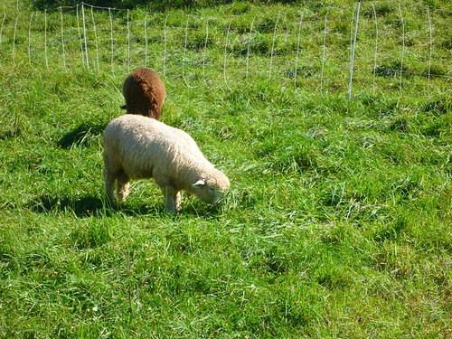
After that, we had rollers on mostly paved roads until we reached Route 2. From there, it was a long climb up a mixture of dirt and pavement until we reached the first checkpoint. We passed grazing sheep and gorgeous views.
There was a little respite when the road turned down, but then it climbed back up toward the first rest stop of the day.
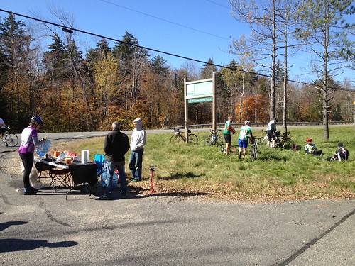
I arrived at Little Big House happy with how the day was going. The segment with the most climbing per mile was out of the way. My low gear was sufficient, though there were times I would have liked something even lower; I came to envy the mountain bikers with their 22/34 low gears. My heart rate had gotten a little high on some of the climbs, but I didn’t feel as if I had exhausted myself prematurely. My legs didn’t feel great, but they were still turning the pedals. I refilled my water, added a little Gatorade powder to one bottle, and chowed down on a slice of watermelon. The volunteers were cheery and efficient, and everyone seemed to be having a grand time. A photographer snapped a few photos of my bike, including a detail of the Honjo hammered fenders.

From the Little Big House to the Green River Covered Bridge: 23.9 miles, 2425 feet of climbing
As we left, we encountered more gorgeous views looking east toward Mount Monadnock. For five miles we had rollers, trending downwards but with just enough up to keep us working. I noticed that I was slowing down on the upward bits and using my lowest gears even on relatively moderate grades.
A photographer in a car—the one who had taken a few photos of my bike at the rest stop—took a few pictures as we climbed the steep grade of Prolovich Road; then her driver pulled ahead of each of us in turn, snapping photos of our effort. She told me not to look at the camera, but to look down at the dirt as if I were struggling to keep going on. I laughed and said I was struggling, but I was having too much fun not to smile! I did grimace obligingly before she left.
Then there was a thrilling 1.25 mile descent into Colrain; I was annoyed by a rider ahead of me who was going a lot more slowly than I, with auto traffic making it impossible to pass. I ended up having to alternate front and rear brakes to slow to his speed. We rode a little more than 3 miles on Route 112, where a large group of motorcyclists passed us a little too closely while revving their engines to produce a gratuitous noise. I don’t know why some motorcyclists feel compelled to do that to bicyclists.
Then another steep dirt climb that took us out of Massachusetts and into Halifax, Vermont. I stopped to answer the call of nature, waving Barry ahead; it would be another 20 minutes or more before I caught up to him. I paused again at a water bottle drop to refill the nearly empty bottle and mix in a little more Gatorade. We passed from sun-dappled forests to beautiful meadows. After another downhill, we started the long climb up to Halifax Center, then County Road past the summer home of a high school friend’s in-laws (they were elsewhere this weekend, so I couldn’t stop by for a brief chat), and finally, after a brief respite, Deer Park Road. By this point I was routinely dropping down into the lowest gear whenever the grade got serious; fatigue had definitely replaced cardiovascular fitness as the limiting factor on my performance.
The reward after we passed the top was a thrilling, occasionally scary descent on bumpy gravel. At one sharp corner, organizers had arranged for EMTs to be posted, and there were several radio relayers on the course, much of which was out of cell phone coverage. I took a hand off the bars to wave to the EMTs and nearly took the corner too widely, which would have been ignominious. Here and there we saw water bottles that had bounced out of bottle cages or riders’ pockets.
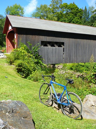
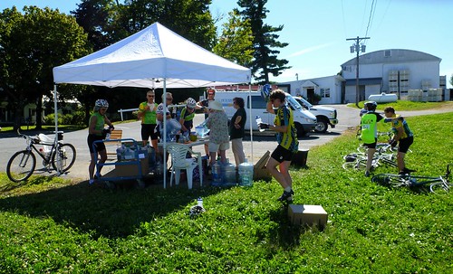
The bumps got to my bike too. As we reached the gentler grades next to a river, I noticed that my bike was making a rattle, and Barry said he could see the fender vibrating. Sure enough, both of the bolts securing the fender stays to the dropouts had worked loose. After a few minutes I had them adjusted, not perfectly but well enough to finish the ride. We continued down along the river, arriving at the Green River Covered Bridge, the lunch stop, at about 12:40 pm.
There were bikes everywhere: propped up on the railings next to the bridge, laid on their sides on the grass, propped up against trees…. There were cyclists everywhere, too; for around 900 riders on the 180K, 115K, 100K, and the 40-mile Green River Tour, this was the place for lunch.

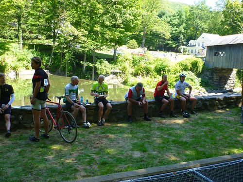
Despite my tired legs, and some lower back pain on the tough climbs, I was feeling pretty good. I verified that the fender was well enough adjusted to survive the rest of the ride, and then I headed for the food. A turkey sandwich, a bag of chips, and some Gatorade later, I was feeling fine. I did have to queue for at least 10 minutes, maybe more, to use the porta-potty; one of the volunteers mentioned that they should get more the next time. As far as I’m concerned, that was the only minor problem with the entire operation. Again, the volunteers were cheerily working their butts off, and the mood was joyous and festive.
Update, 8/26: Robert Kerner, one of the other riders, took this picture at the lunch site; I’m in the center, bending over to check my front tire pressure:
Photo copyright © 2013 Robert Kerner; linked to Flickr
From the bridge to Apex Orchards: 15.4 miles, 1216 feet of climbing
After a 40-minute lunch break, Barry and I were both ready to continue. We had 10 miles cycling gently downhill along the Green River, first on dirt and then on pavement. My highest average speed of the whole ride was here. The idyll ended when we made a hairpin turn heading up the hill: back to grinding uphill on dirt. One long climb was succeeded by a thrilling downhill on mixed pavement and dirt, and then a shorter but steeper climb brought us up to the aptly named Apex Orchards, where again we had a stunning view to the east.

Most riders had peaches. I had pickles. And a last water bottle refill. As we thanked the volunteers for being there, they thanked us: one of them said, “Without you, we wouldn’t be here.” True—but then, they wouldn’t need to be there! I gave Jennifer a call to let her know I would be in Deerfield in just over an hour; she was on her own ride up to Leverett and Shutesbury, so I left a voicemail.
From Apex Orchards to Deerfield: 12.4 miles, 858 feet of climbing
The last fifth of the ride seemed longer than it should. We had a downhill stretch that brought us briefly to Route 2, then another climb. Barry’s front derailleur was shifting worse and worse. After another bumpy descent on gravel, we returned to Route 2. By that point, his front derailleur wasn’t shifting down into the small ring at all: a clear problem given the climbing that remained. We figured out that his inner limit screw had vibrated in, preventing the derailleur from shifting far enough to the left. A half turn of the screw fixed the problem and we continued, down Zerah Fiske Road and then up Lucy Fiske Road. We had a brief roller on pavement, then a nice descent on Taylor Road to the fork with Hawks Road.
Hawks Road is infamous among D2R2 riders. It descends on pavement, then climbs on increasingly narrow, rocky dirt, before descending for a mile along a twisty route with lots of rocks and washed-out areas. We saw the photograher from Little Big House and Provolich Road for a third time. We also passed one cyclist who seemed to be dealing with a flat, but it was too steep and treacherous for small talk. After watching me swaying around more than I should, Barry gave me some tips from his mountain-biking days about putting more weight on the bike. Despite my caution I might have beat my previous time down this road, but for the fact that my downtube water bottle cage had loosened up! I thought it had been pretty tight, but maybe I’ll use threadlock before my next gravel road ride. It didn’t take long to tighten the screws, but as I worked on it, a couple riders, probably thinking I was daunted by the hill ahead, told me it was the last one! To be fair, I wasn’t exactly looking forward to climbing it, even though I had done so two weeks before and knew what to expect.
After Hawks Road, it was an easy three miles back to the start/finish line. I crossed the line, heard a beep, and stopped my computer. My ride was over. I was tired, my back was sore, and my knees had been twinging on the last few climbs. I could have kept on riding for a while, but I decided to forego the optional concluding loop through Historic Deerfield.
After the ride
Barry was heading back to his car, at the camping area, to put away his bike, and then he was going to catch a shuttle to the showers, so we said our farewells. As I was trying to find the check-in for riders, someone saw my bike and introduced me to Mike Kone, of Boulder Bicycle and René Herse Bicycles; I thanked him for his guidance and help ordering and assembling my bike, and we paused for a photo.

Unfortunately, after meeting Mike, and being generally befuddled, the check-in slipped my mind. I went to prop up my bike and call Jennifer to follow up on my voicemail. She answered, saying she had just parked the car when her phone rang. We met up, I put my bike and gear in the car, and then we went for some food; I had bought an extra meal ticket for her, and she hadn’t eaten since her own bike ride. Food was copious and pretty good; we had pulled pork, a biscuit, a salad, and cupcakes. Mine was washed down with a glass of the Berkshire Brewing Company’s Preservation Ale!
Then we headed home. On our way out of the parking lot we saw an ambulance and police cruiser, lights flashing, near the finish line; a minute later a Northampton Fire Department ambulance rolled up. I hope that it wasn’t for anything serious.
When we got home and I took my ride number bib off my jersey, it struck me that I had never checked in at the arrival. Oops! I felt like an idiot for being so easily distracted. I didn’t want the organizers to worry, especially since I hadn’t left a car in the lot, so I fired off a quick email to the two contact people to let them know. I hoped at least one would be checking email, since I couldn’t find a ride day contact phone number. Fortunately, Mary Lynn got the message minutes after I sent it.
Post-ride reflections
As this was my first D2R2, I didn’t know what to expect. Other than suffering; that much was clear from the ride reports I had read online, and the way everyone talked about the ride. I know most of the reports are about the 180K; I’m not that strong a rider—yet—and the 100K doesn’t have anything close to Archambo Road, with its 28% wall. But it was tough. I’m satisfied to have completed the ride, and to have done so in just over 6 hours of actual riding time.
The Franklin Land Trust and volunteers did an excellent job organizing the event. My hat is off to them. Over a thousand cyclists participated in this year’s D2R2. Pre-event communication was very helpful. The registration and food areas looked a little chaotic when I arrived, but that was simply because of all the cyclists milling about. The event staff had everything down cold. Picking up my registration material and T-shirt were a cinch, as was finding a little pre-event food. At the checkpoints, everyone was smiling and efficient. I might suggest a couple extra porta-potties at the Green River checkpoint. And it would be helpful to have a phone number to contact an on-site organizer on the day of the event, so that boneheaded folks like me who forget to check in at the end can call up; a Google Voice number could be set up to forward calls to one or two organizers’ cell phones.
The roads themselves were beautiful. The light and temperature helped: it was cool riding through forests, with many small brooks running alongside them, then amazing to burst out into a meadow and see a distant ridge or mountain. There was the occasional car, especially on the short stretch of Route 112 and on Green River Road, but they were few and far between. I know that’s true of many back country roads around here; as a local, I’ve been able to ride many of them. But these were pretty darn good even by comparison with our usual lot.
Finally, being surrounded by so many cyclists in good spirits, clearly having a good time as they challenged themselves, was exhilarating. I’m used to cycling alone or with Jennifer. I don’t think I would want such camaraderie on every ride; I’m too much of an introvert. But once or twice a year, it’s not bad. I’ll be back—if not next year, then soon.
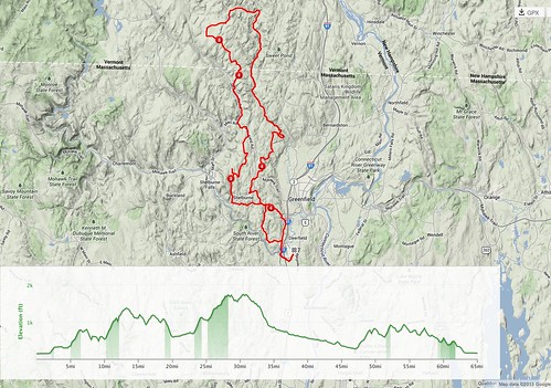
Statistics, map, and elevation profile
Distance: 65.1 mi/104.8 km
Elevation gain: 6631 feet/2021 m (per my GPS; TrainingPeaks claimed 7420, and the organizers, 7800)
Moving time: 06:04:17
Elapsed time: 07:22:50
Average moving speed: 10.7 mph/17.2 km
Average speed including rests and lunch: 8.8 mph/14.2 kmh
Maximum speed: 40 mph/64.4 kmh
Average cadence: 70
Calories burned: 3228 (per Garmin Edge 800)
Calories consumed before ride: 519
Calories consumed during ride: 852
Five days to D2R2
4722 days ago
With five days to go, there’s not much more I can do to prepare for D2R2. I’ll do one or two more short fast rides this week, and maybe one long hill climb, but my main goal is not to tire myself out too much. That’s what Saturday’s ride is for!
The last two weekends I did a couple longish (around 50 mile) rides in the hills northwest of here as part of my training. Each had at least one long hill climb and some other short, steep hills. On August 10 I rode up to Williamsburg and Conway, then followed back roads up to Bardwells Ferry (which now has a bridge) and the tail end of the D2R2 route on Hawks Road. (Strava map here.) The descent on Hawks Road was, as the D2R2 cue sheet puts it, gnarly: not too steep, but in many places part of the dirt has been washed out, and there are a number of big stones. It wasn’t too bad to descend by myself, but with a number of other cyclists around, finding a comfortable line might be challenging.
Yesterday I went in the same general direction but a little further west, to Ashfield. (Strava map here.) I hit a few back roads that are less traveled, by car and bike, and had a blast. There were some nasty hills, but nothing I couldn’t handle. D2R2 will involve a lot more climbing, but I’m hoping that if I pace myself, I’ll do OK. I’m not out to set any records.
I did each ride after a light lunch, and during each I ate one pastry and drank 2-3 bottles of diluted Gatorade. I’ll need to eat a little more at D2R2, but I figure breakfast before the start, a snack at the Little Big House and Apex Orchards, and a sandwich at the Green River lunch stop, along with a couple bottles of Gatorade, should suffice. I’ll bring some Clif bars, shot blocks, and Gatorade powder with me, just in case. One consequence of dieting for over seven months is that I seem to have become an efficient fat burner! I’m now down 35 lbs. since January.
My bike is now set, except for cutting the steerer (and installing dynamo lights, but I won’t need them for D2R2). I plan to get the steerer cut tomorrow or Wednesday. I can ride with it in its current state, as long as I don’t mind being ridiculed, but the bike will look so much better when it’s cut. During a couple of my recent rides, fellow cyclists were admiring the bike; I’m happy with the way it turned out.
Back on the bike
4737 days ago
July has come and gone, and it’s now fewer than three weeks to D2R2. I didn’t do as much cycling in July as in June: 300 miles vs. 492. We did a little traveling with our French guest, and I had a cold for the last week that I’m just getting over.
With D2R2 coming up, though, it’s time to get back on the bike. I’m doing a 35-mile loop this afternoon, and then I’ll get in some hill repeats in the coming week. I plan a longer hilly ride next weekend, and a still longer one on the 17th or 18th. Then it’ll be time to taper before the event. It will be a challenge, but my goal is simply to finish, so as long as I don’t start out too fast, I should be able to do it. Famous last words….
And I’ll need to do a lot of writing in the coming month to meet my deadlines, both external and self-imposed. Classes start again in just over four weeks.
In other news, the Boulder All Road is done, except for cutting the steerer and hooking up the lighting system. (OK, I also need to set up the decaleur to use with my handlebar bag.) It doesn’t look too bad, if I do say so myself!
Late Summer/Fall 2013 cycling events in the Pioneer Valley
4739 days ago
Strange as it may seem, there doesn’t seem to be a comprehensive listing of cycling events in the Pioneer Valley for late summer and fall available online. Here’s my attempt to draw one up. Please let me know if you find this page and (a) think it’s useful or (b) have an event to add. I’ll be fleshing out the list, and adding URLs, as I gather info. When I have a URL, the heading title is linked to it.
Hat tip to Gina Nortonsmith at Pedal Paradise, whose post from 2011 gave me a model!
Saturday, August 17, 2013: Berkshire Brevets 300K
Starts and ends in Westfield.
Saturday, August 24, 2013: D2R2 (Deerfield Dirt Road Randonnée)
Rides from 40 to 110 miles through the hills of Franklin County and southern Vermont. Mostly dirt roads, lots of climbing.
Saturday, September 7, 2013: Berkshire Brevets 600K ride
Starts and ends in Westfield.
Sunday, September 8, 2013: COVAC Connecticut Valley Century
Starts and ends in Hatfield, MA. 25-, 50-, and 75-mile options also available.
Saturday, September 21, 2013: Northampton Cycling Club BikeFest and Tour of the Valley 2013
Look Park, Florence, Northampton.
Sunday, September 29, 2013: Will Bike 4 Food
Charity ride to benefit the Food Bank of Western Massachusetts, with 10, 25, 50, and 100-mile options. Starts and ends at the Food Bank in Hatfield, MA.
Saturday, October 5, 2013: Sunderland Fall Festival and Clover Century
Details not yet available this year.
Sunday, October 13, 2013: Great River Ride
Starts and ends at the Sons of Erin, Westfield, MA. Options from 35 miles to 180K.
Last update: 2013-08-02, 7:28 pm
Visitor: blogging hiatus
4761 days ago
My wife and I are hosting a French teenager for the month of July, which means both less biking and much less time for blogging and social media. My blogging here has been sporadic anyway, but don’t expect much between now and August 1. If I manage to finish the All Road before then, I might post a picture.
Short Cape Ann getaway
4777 days ago
Jennifer and I had been thinking of going to Cape Ann for a brief getaway, to do some exploring on bike. On Saturday morning, the weather seemed like it would be decent on Sunday and Monday, so we booked a couple nights in a hotel in Gloucester and I planned some bike routes.
Between Rubel’s bike map for Cape Cod and the Northern Shore, which indicates roads that are relatively friendly to bike on, and RideWithGPS’s ride database created by the site’s users, I was able to identify several possibilities.
Sunday: around Cape Ann (Gloucester and Rockport)
By the time our room was ready at the hotel on Sunday, we didn’t have time for a really long ride, so we did a 22.7-mile loop around the end of the cape, starting from our hotel at Bass Rocks and heading counterclockwise. We visited Rockport, saw the abandoned quarry—now a nature preserve—at Halibut Point State Park, and rode through the quaint village of Annisquam. Crossing the footbridge that links the mainland to the peninsula where Annisquam is situated, we saw a number of Great Egrets hunting fish in the outgoing tide. The Great Egret was the signature bird for our trip; we saw a number earlier, and we’d see more on Monday. Heading back south into Gloucester, we took mostly nondescript side streets until we hit Route 127 just north of Gloucester Harbor. A quick trip back to our hotel, and it was time to wash the grime off and relax a bit.
Though we were riding in the late afternoon and early evening, it was warm: the average temperature was 82. We had a moderate wind from the SSW. The terrain didn’t have any long hills, but there were many small rollers.
We had an excellent dinner at the Alchemy Café and Bistro, which we highly recommend. Back at the hotel, we sat on a bench and watched as the moonlight, which was filtered through light cloud, illuminated the surf rushing in against the boulders. Then it was time for a good night’s sleep.
For the curious, here is the Strava track for Sunday’s ride.
Monday: Essex, Ipswich, Manchester, and Gloucester
Someone thinking of English geography would conclude that we really got about on Monday! The cycling was more of the same: short, sometimes steep rollers, none of them long but a fair amount of climbing by the end of the day. Our first destination was the Crane Reservation, which belongs to the Trustees of Reservations, a private land conservation group in Massachusetts. For most people, the main attraction was its beach. There’s also a wildlife preserve and a historic house and inn, but we didn’t feel like hiking through the sand in blazing sun—temperature in the mid-90s—or visiting a house in our sweaty bike clothes.
After a lunch at the beach snack bar, we decided to give the Ipswich town center a miss and instead headed back through Essex, whose main attraction seems to be antique shops, seafood, and a marina that offers river tours. We headed south, crossing the cape to Manchester-by-the-Sea. There, we refilled our water at a convenience store and headed back to Gloucester, passing a faux medieval castle and museum on the way (closed, unfortunately). We stopped at a park for creemees and to walk around a bit, and found a plaque commemorating the establishment of the Massachusetts Bay Colony, followed a couple years later by the successful arbitration of a difference between two factions of colonists.
Our final leg took us through East Gloucester and then down through the private development of Eastern Point, where we saw how the top 5% live (many of them probably in the top 1%). As members of the Massachusetts Audubon Society, we had the right to go through the development to access the MAS sanctuary at the southern end. We didn’t see much wildlife, other than gulls and cormorants, and a number of mosquitoes. So it was back along the eastern shore to our hotel and another welcome shower, followed by further hydration.
Dinner was at a pretty good Portuguese restaurant, which we reached just as a torrential thunderstorm started. We only caught a few drops, and then watched the heavens pour down while dining. By the time we were done, the rain had all but stopped, so we could stop at a supermarket for dessert chocolate. Back in our room we had decaf coffee and herbal tea, then had another good night’s sleep.
As before, here’s the Strava track for the ride.
Tuesday morning it was time to pack up and head back home, so we could get back to work and vote in the special election for the Senate. It was hot, which tempered our desire to linger and see a bit more. Overall, it was a nice getaway. There was a striking contrast between the grittiness of parts of Gloucester, the modest coastal houses in some areas, and the sprawling mansions that were built, or were in the process of being built, in other areas. It was also striking how much of the cape’s interior was undeveloped. The Boston conurbation has sent many tentacles into Cape Ann, including Route 128; it was less rural overall than we had expected. But still, it was nice to see the area, and to add four more towns to my map of Massachusetts towns where I’ve cycled!